.jpg)
Bridge bethlehem
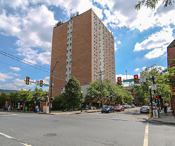
Bethlehem’s two distinct downtowns are physically separated by the Lehigh River. The river played is an invaluable natural resource offering stunning views—but it also poses a physical barrier that has traditionally made it difficult to connect and unify the two downtowns into a cohesive whole. The vision for a Bethlehem Pedestrian Bridge arose as very much a grassroots effort driven by local residents as a way to begin to unify the city, enhance the links for pedestrian safety and the current trail network and to create greater access to the Lehigh River. In 2016 a grassroots Pedestrian Bridge Committee was created as a “Public Collaboration to Promote Safe Passageways for Pedestrians and Bikers across the Lehigh River”. It was determined that a feasibility study was necessary to prepare for next steps in the bridge development and to fully understand the scope of a project of this magnitude. Funding was provided by both PA DCNR and Northampton County to make the feasibility study possible. The Feasibility Study provides a comprehensive strategy for the City and the community to realize a safe pedestrian and bicycle crossing over the Lehigh River in Bethlehem. Development of such a bridge has wide-reaching potential to positively impact local economic development, tourism, climate change, property values, transportation alternatives, and as a result, the quality of life for all who live, work, and visit the area.
Bridge-Bethlehem-Study
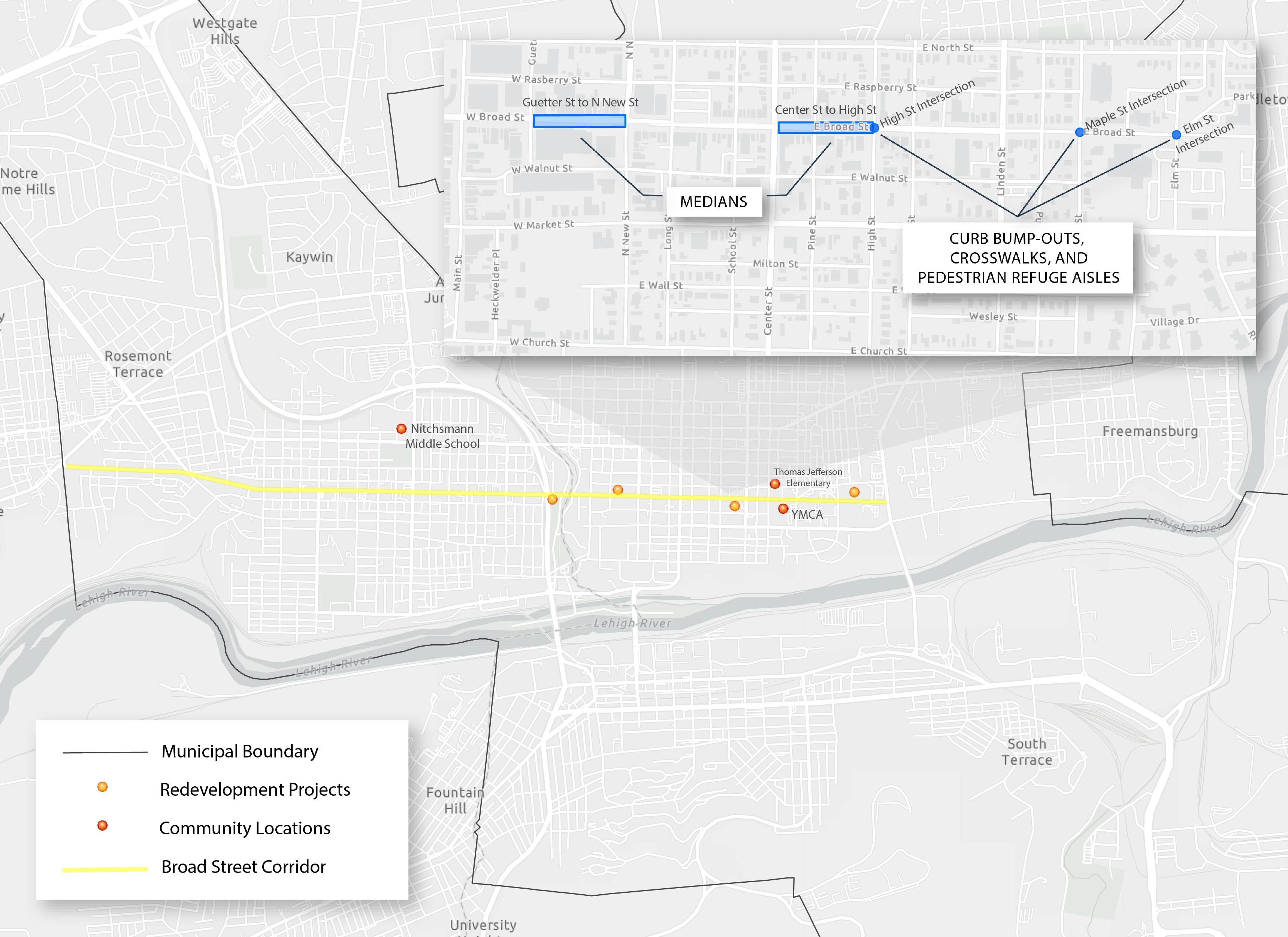
Broad Street Active Transportation Plan
This Active Transportation Plan provides a long-term planning blueprint for safely accommodating all users of Broad Street in the City of Bethlehem, Lehigh and Northampton Counties, PA. This plan is intended to serve as a resource to guide the improvement and transformation of Broad Street.
Broad Street Active Transportation Map
Broad Street Active Transportation Plan
comprehensive Parks and Pools Study (2017)
The intent of the study is to provide a detailed and honest evaluation of current conditions of recreation lands, recreation facilities, buildings and pools, stormwater management and environmental responsibility practices, recreation programming as well as park maintenance and operations.
Comprehensive Parks and Pools Study
Southside Historic Conservation District Study
Bethlehem is conducting a SouthSide Bethlehem Historic Conservation District Study to review the Design Guidelines and make recommendations on changes regarding but not limited to issues such as height, administration, submission requirements.
South Bethlehem Historic District Planning Study
South Bethlehem Historic Conservation District Design Guidelines
Beth Connects: A Trail Study
Bethlehem recently completed a Trail Study, “Beth Connect: A Trail Study”, to outline a program to build on the existing trail network in and around Bethlehem by closing trail gaps, and by connecting Bethlehem’s trails to destinations outside of the City and to larger trail networks. The study suggests ways to promote recreation and cultural amenities through the trail network and to enhance the vibrancy of neighborhoods and businesses in and around the trail network. Goals of the Study include:
- Developing safe alternative transportation routes within the City
- Making Bethlehem a trails hub by connecting the trails to parks, historic sites and neighboring communities
- Providing better connection to Bethlehem’s north and south side downtowns
- Increasing viability of businesses that cater to trail users
- Increase public awareness of existing trails
- Engage many partners, in and out of City Hall, to ensure the sustainability of the trail network for future generations
Southside Streetscape Enhancement Plan for the South Side Community Benefit District (2013)
The Streetscape Enhancement Plan for the Proposed South Bethlehem Community Benefit District is part of an ongoing process to facilitate the economic revitalization of South Bethlehem.
A Streetscape enhancement plan is recognized as a necessary initiative to enhance the livability and activity in the downtown area. This Plan is not an attempt to design an entire streetscape system, but rather to study and highlight some targeted areas and provide examples of how streetscape enhancements can bring vitality to the downtown. The Plan was prepared by Lehigh University in Partnership with other South Bethlehem community organizations and local businesses and the CIty of Bethlehem.
South Bethlehem Eastern Gateway Vision Plan
The Eastern Gateway Vision Plan is a community driven report providing ideas for enhancing the major eastern entranceway to South Side Bethlehem, marketing the neighborhood, creating renderings of possible streetscape amenities, and suggesting signage and wayfinding ideas to direct residents, nearby employees, and visitors to all the diverse opportunities offered here.
One of the main goals of the Southside Vision 2012 (now 2014) Plan is to improve the gateways leading into Bethlehem, especially the Eastern Gateway. After a neighborhood visioning party where community residents were challenged to look at their public spaces and make suggestions for improvements and after 13 separate focus groups of community experts convened to discuss ways to enliven and redesign the neighborhood, the plan was finalized in late summer 2011. Implementation of this plan will create exciting and highly visible public spaces as well as much needed retail, service, and residential development in this crossroads neighborhood. The plan was completed in partnership with the Community Action Committee of Bethlehem
Historic Preservation Plan
In 2009, the City of Bethlehem received a federal Preserve America grant to complete a citywide Historic Preservation Plan (the “Plan”). Bethlehem used this opportunity to create a cohesive strategy to ensure that significant historic and cultural assets in the City—including buildings, neighborhoods, industrial remnants, oral histories, cultural sites and traditions—are preserved and utilized for positive economic and community development. The final plan is attached for reference.
The City Livable
Modest Proposals for a More Walkable Downtown
In 2009, Jeff Speck, the City’s consultant on walkability and other related planning issues, developed a report based on the conviction that a successful city is one in which people choose to walk. If people are not fully comfortable using the City as a pedestrian, then the City will never provide the high quality of life that is now demanded in our communities.
Modest Proposals for a More Walkable Downtown
Southside Vision 2012 - Southside Residential Master Plan 2002 - 2012
The Southside Vision 2012 plan is funded through the Community Action Development Corporation of Bethlehem (CADC-B) and their parent organization, the Community Action Committee of the Lehigh Valley (CACLV) with tax credits from the Pennsylvania Department of Community and Economic Development. The City partnered with CADC-B to complete the plan to develop a strategy for addressing some of the issues and opportunities in the neighborhoods on the south side. The plan was completed in 2002 and a steering committee has been developed to facilitate with the implementation of the recommendations of the plan. The program was previously granted a 2 year extension to 2014. In 2014 the program was reinstituted for another 6 years. The steering committee structure will continue for the next 6 years but will be reorganized to reflect new goals and objectives for the program.
South Bethlehem Greenway Master Plan
South Bethlehem Greenway Plan adopted in 2005, the Greenway Plan has been a guideline for Greenway development. The Greenway plan will continue to be referenced as the South Bethlehem Greenway is developed.
- Report Cover (263 KB)
- Report Title and Table of Contents (155 KB)
- Section 1 - Executive Summary (478 KB)
- Section 2 - Inventory/Analysis (1.69 MB)
- Section 3 - Greenway Concepts (3.77 MB)
- Section 3 - Site Plans (part a) (30.16 MB)
- Section 3 - Site Plans (part b) (18.55 MB)
- Section 4 - Development/Phasing (365 KB)
- Appendix - (5.58 MB)
Downtown Market Analysis
The City of Bethlehem conducted a retail feasibility analysis of the Northside Historic District and the Southside Arts District to determine how much additional retail and restaurant development is able to be supported:
Northside Historic District
Northside (2021 Update)
Northside (2022 Update)
SouthSide Arts District
SouthSide (2021 Update)
.jpg)